| wms operations getmap layers size map |
"Create a WMS client targeting the IGN WMS server"
wms := OWSServiceWMS new.
wms url: 'https://data.geopf.fr/wms-r'.
"Introspect the server capabilities"
operations := wms operations.
# 'operations' is a XMLOrderedList(
# a OWSServiceWMSOperation <GetCapabilities>
# a OWSServiceWMSOperation <GetMap>
# a OWSServiceWMSOperation <GetFeatureInfo>
# )
"Listing available image formats for maps"
getmap := operations detect: [ :request | request name = 'GetMap' ].
getmap formats.
# 'formats' is an OrderedCollection(
# image/jpeg
# image/png
# image/tiff
# image/geotiff
# image/x-bil;bits=32
# )
"Listing available layers"
layers := wms layers.
# 'layers' is a XMLOrderedList(
# a OWSServiceWMSLayer(ADMINEXPRESS-COG-CARTO.LATEST)
# a OWSServiceWMSLayer(ADMINEXPRESS-COG.2017)
# [...]
# )
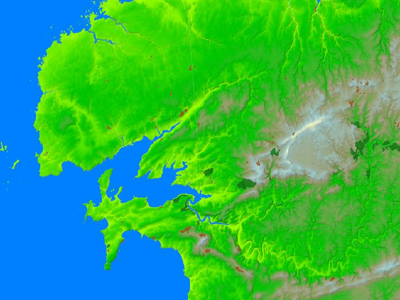
"Download a raster map with two layers for a bounding box defined by EPSG:3857 coordinates"
map := wms
map: { 'EL.GridCoverage'. 'FORETS.PUBLIQUES' }
bbox: (-546079 @ 6126282 corner: -398839 @ 6212047)
size: 800 @ 600
epsg: '3857'
format: 'image/png'.
# 'map' is a Bitmap